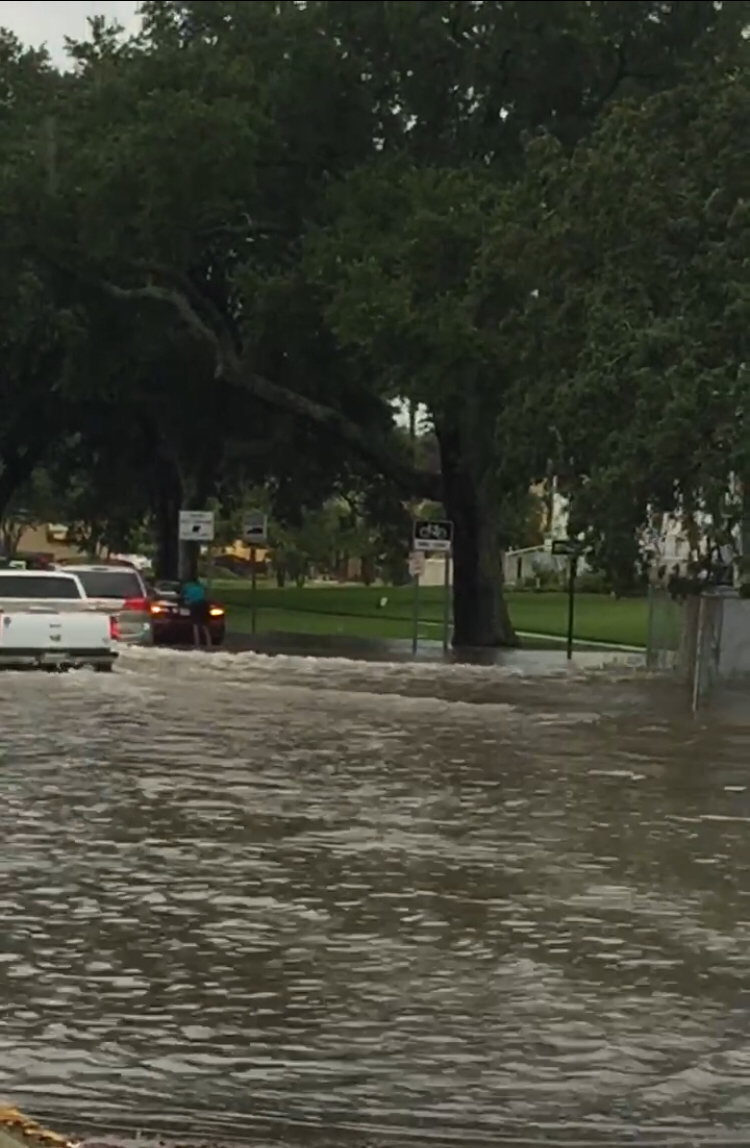
Tropical Storm Gordon is expected to make landfall on Tuesday afternoon or night as a Category 1 hurricane. Although Gordon’s projected path is just east of Louisiana, Officials and weather professionals ask that residents of southeastern Louisiana prepare for severe weather and review household disaster plans.
According to an update from the National Hurricane Center at 7 p.m. Monday, Gordon is expected to gain strength gradually over the next 36 hours and maximum sustained winds have increased to 60 mph.
OK, so does this mean you need to board up your windows and hunker down or just buy more rum? Well, here’s our list of what you should do to make sure you’re fully prepared before Gordon makes landfall.
Get prepared
- Find shelter inside.
- Secure outdoor furniture, plants, garbage cans.
- Clear gutters and catch basins of any debris.Report clogged catch basins to 311.
- Move your car to higher ground if in an area susceptible to street flooding. Parking restrictions will be suspended starting at 2 p.m. Tuesday.
- Keep your flashlights, candles, batteries nearby so you do not need to fumble for them in the event of an electrical outage
- Make sure all cell phones and necessary electronic devices are fully charged
- Restock your hurricane prep kit, if needed. (Here’s what should be included.)
- Make sure your pets are a part of your disaster plan
Don't forget your furry 🐱🐶, feathery 🐦, and/or scaly 🐍🐠 friends when making your disaster plan. Your pets' lives depend on YOUR planning! #NatlPrep #lawx #mswx pic.twitter.com/H9ochKVqmw
— NWS New Orleans (@NWSNewOrleans) September 3, 2018
- Stay informed of weather updates. Check your local news outlets online, tv or radio for the latest updates. Follow @nolaready on social media or at ready.nola.gov to get the very latest from city government about weather-related changes.
- Follow Streetwise to be aware of any street closures, flooding and accidents, in the event you will need to leave your home and travel on any roadways
- Sign up for emergency alerts. Text your zip code to 888777 or go to ready.nola.gov/alerts.
- Call 911 in an emergency. Call 311 for information or to report non-emergency service requests like downed trees.
State of Emergency Declared
Gov. John Bel Edwards has declared a State of Emergency for the state. He said, “The threat of severe weather continues to exist for Louisiana” and Gordon “has every possibility to track further in our direction.”
On Tuesday morning, 200 National Guard members, will be deployed to SE Louisiana, Edwards is sending 63 high-water vehicles, 39 boats and four helicopters to the New Orleans area as well.
https://www.facebook.com/LouisianaGov/videos/232829304243752/
Mayor LaToya Cantrell has declared a State of Emergency for the city of New Orleans as well. All city personnel should not report to work and city government offices will be closed.
https://www.facebook.com/mayorcantrell/posts/676848962685089?__xts__[0]=68.ARCvyche3SUf9niVmXXua0jK_ZVv28GTIzcZbV-oVT0HmK1J4hODnGgNlMFNfd70ESHhE96-Sq_D-GZscPp2OgHxqZBMkEdFV5NLd78EYNL6Dk4DLRYEbQ6vqRUJVS_BQPaozl1gtXfdzlE_T0YLd5dxo_TpyXF5cLWib_T44C3EnXbdsg7e&__tn__=-R
Warnings and Watches
New Orleans is under a tropical storm warning, a flash flood watch from Tuesday through Friday and a coastal flood advisory until 8 p.m. Check the National Weather Service for changes and updates to these weather advisories.
Expected Rainfall, NOLA Drainage Update
New Orleans is expected to receive up to 6 inches of rain. Mayor LaToya Cantrell said that the drainage system is ready and equipped to handle the expected rainfall, after undergoing $80 million in updates and improvements over the last year.
From the City’s Tropical Storm Gordon update at 5:07 p.m.
The drainage system has 116 out of 120 pumps available, with a 1,000 cubic-feet-per-second pump back online for emergency use at Drainage Pumping Station 13 in Algiers. The agency can produce more than 77 megawatts (MW) of 25 Hz power – more than what is needed to run the entire drainage system. Turbines 3, 4, 5 and 6 are available to provide power, and turbine 1 is available for emergency use. Crews are standing by, ready to operate every large pump station and to monitor automated stations and pumps at underpasses.
https://www.facebook.com/mayorcantrell/videos/744445995898204/
School closures
All Orleans Parish Schools are closed Tuesday. Loyola and Tulane universities remain open. For an updated list of school closures, check here at NOLA.com.
https://www.facebook.com/OrleansParishSchoolBoard/photos/a.177679605631440/1965523856846997/?type=3&theater
https://www.facebook.com/TulaneU/posts/10156387688786013?__xts__[0]=68.ARD6NIcnix4PAImS6yAvKAxvnmGZN6zWLmvzgWaxavm6f6-XvUpjOQbZBBAzFzyphI3LHnjingQlTSlcdYJbdKqccca2ba8PLrf-cfvITJzCYSpQXQIvHWUXztGxOFM6SVx9SVeoF2-_cKOpXz2Bpj7JSFlYVWqarTeXqYgn8ZBEdexx5gm9rOE&__tn__=-R
Loyola University New Orleans has been monitoring #TropicalStormGordon. #LOYNO will continue normal operations tomorrow, Tuesday, Sept. 4. Classes will be in session on both the Broadway and main campus. Visit https://t.co/3NgAyZCrm6 for updates. pic.twitter.com/D87YInO2an
— Loyola New Orleans (@Loyola_NOLA) September 3, 2018


